-
Responsible Management
Responsible Management
Explore this section to find information and resources designed to support managers and regulators

-
Preparing for a trip
Preparing for a Trip
Explore this section to find information and resources useful to anyone interested in learning more about responsible whale watching throughout the world
-
Industry support
Industry Support
Explore this section to find information and resources useful to whale watching tour operators and guides or other industry professionals
-
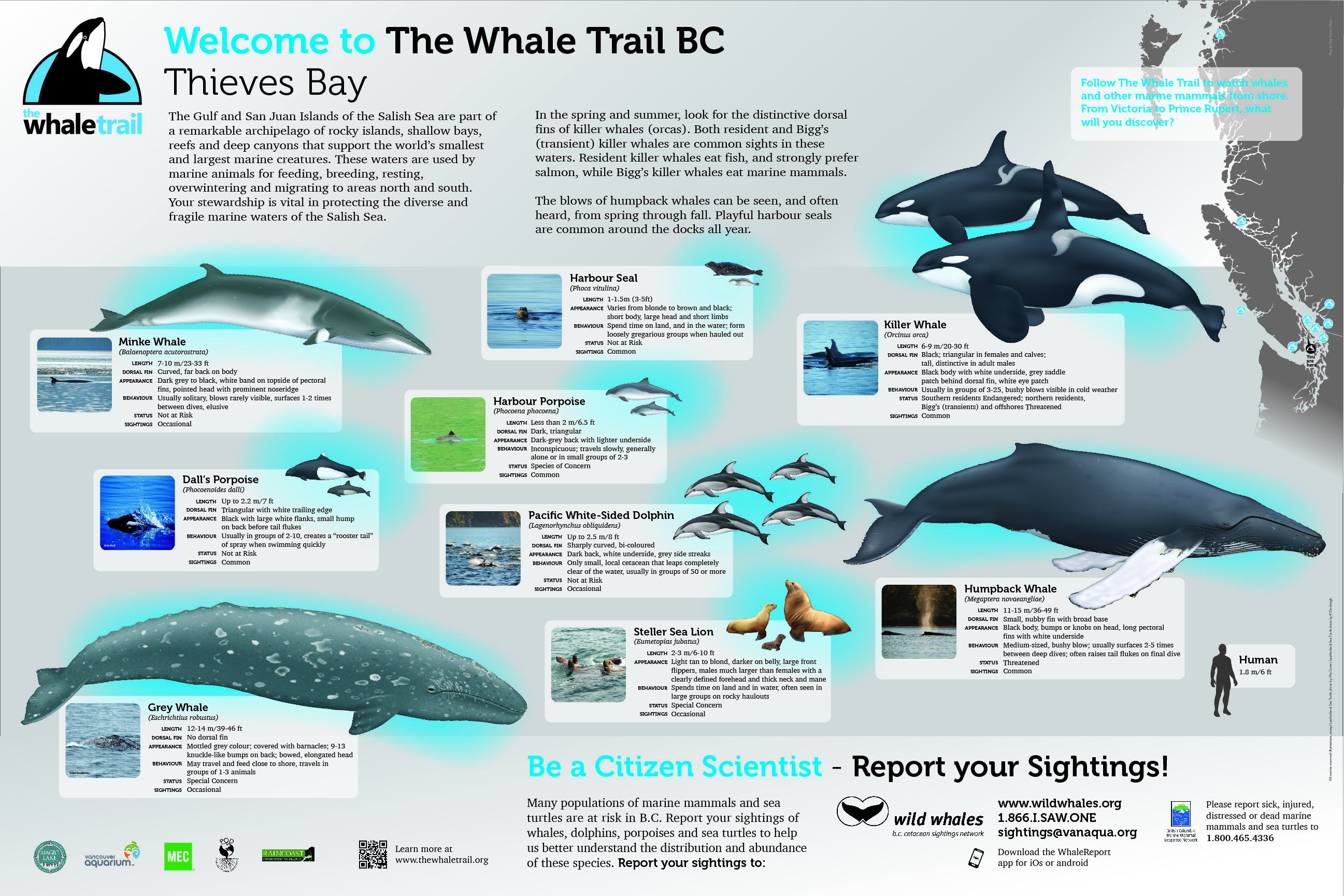
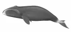
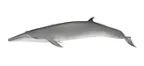
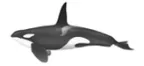
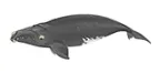
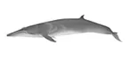
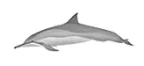
Species information
Species Information
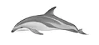
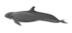
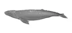
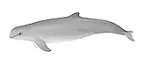
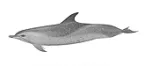
Click on one of the icons to the right to reveal a full description of the species with photos and labeled illustrations useful for species identification, as well as information on biology, ecology and conservation status of each species. Click here to find downloadable PDF fact sheets for each of the species featured on this site.


United States and Canada: The Whale Trail Promoting and facilitating land-based whale watching on the Pacific Coast
History and context
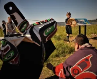
In 2002, citizen stakeholders, the United States National Oceanographic and Atmospheric Association (NOAA Fisheries), Canada’s Department of Fisheries and Oceans (DFO) and the Vancouver Aquarium joined forces to successfully rescue, rehabilitate and return an orphaned killer whale named Springer to her native wild pod in the Puget Sound. The risky undertaking was more successful than almost anyone could have hoped for, with Springer successfully reunited with her native pod, and now producing healthy calves of her own. The experience created a bond between the individuals and organisations that participated in the rescue, including citizen stakeholder Donna Sandstrom.
While Springer thrived, the Southern Resident Killer Whale population began a precipitous decline, to the extent that they were declared endangered in 2005. Alarmed at their plight, and inspired by Springer’s success, Donna Sandstrom left her career in software development to found a programme focused on building awareness about Southern Resident Killer whales and other marine mammals.
The programme’s inspiration came from Donna’s childhood in California, where a series of mission bells along Highway One connect travelers to the historical significance of the road. What if a similar series of signs could educate people about killer whales, and where to watch them from shore? In 2008, Sandstrom coordinated the first meeting to turn this concept into a reality, reuniting many partners from the Springer rescue, and inviting new partners to join in the effort to create the Whale Trail. The founding partners included NOAA Fisheries, the Washington Department of Fish and Wildlife, People for Puget Sound, Seattle Aquarium, and the Whale Museum. The partners agreed to focus on four main objectives:
- increase awareness that the Northwest Pacific waters are home to orcas and other species;
- connect visitors to orcas, other marine wildlife and their habitat;
- inspire stewardship and build community; and
- promote land-based whale watching.
They selected 16 inaugural sites, created a website, and set about designing and producing the first signs that would be installed at the shore-based whale watching sites they had selected. The first signs were installed in 2010, along the Strait of Juan de Fuca. Over the next few years, signs were installed on every Washington State ferry, throughout the Salish Sea, and along the Pacific Coast. In 2014, through a partnership with National Marine Sanctuaries, West Coast Region, the project expanded to California, adding signs in Monterey, Santa Cruz and Point Reyes. In 2015 the team partnered with the BC Cetacean Sighting Network to add sites and signs throughout British Columbia, and with an Oregon team to add sites there.
The founding goal of The Whale Trail was to add sites and signs throughout Southern Resident Killer Whale range. As the project expanded beyond SRKW range, The Whale Trail has a new goal to extend from Baja to Alaska, along the gray whale migration route. There are now more than 90 Whale Trail sites, spanning the west coast from California to British Columbia. Through the current sites and signs, including 2 on every Washington State ferry, the project reaches more than 90 million people each year.

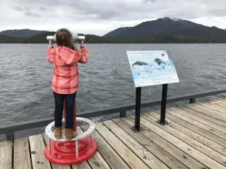
How does the Whale Trail work?
Whale Trail sites are located in city, state, county and national parks, and tribal lands. Each site has a page on the project’s website, and many feature interpretive signs. Visitors can use the website to plan trips to shore-based whale watching sites, and learn about the marine mammals at that site from the information on the website or the interpretive panels.
When new regions are added, a local team is formed to ensure that the right stakeholders are involved, that interpretive panels are accurate in the information they provide, and well suited to the particular needs of that new community. Through this approach, in addition to the founding partners, the core teams now includes a multitude of stakeholders including national marine sanctuaries, the British Columbia (BC) Cetacean Sighting Network, state parks and agencies, and citizen groups in each of the regions where sites have been established.
The Whale Trail is recognised under US law as a 501(c)3 nonprofit organization, based in Seattle, and the project’s work is supported through grants and individual and corporate donations, as well as direct and in-kind contributions from the project’s partners.
In addition to the establishment of Whale Trail sites, the project engages in various outreach and education activities, including training of local residents to become ‘Orca Stewards’, educational activities for school children, and a lecture series featuring researchers, biologists, educators and artists. The Whale Trail is creating a new platform for citizen science, and encourages the use of Whale Alert to report marine mammal sightings. Whale Alert is an app developed by a consortium including Point Blue, Conserve IO, NOAA Fisheries, National Marine Sanctuaries and the International fund for Animal Welfare. Data collected along The Whale Trail will contribute to research and understanding of marine mammal (seasonal) distribution as well as alert other users to active ‘hotspots’ where marine mammals are viewable from shore at any given time.
Learn more about the Whale Trail Story from this video.
Lessons learned and visions for the future
The project’s success so far can be attributed to a number of strengths:
- Clear and Shared Vision. The partners working on the project have a clear and shared mission and goals (see above). This keeps everyone focused and moving in the same direction. At the same time, each partner has brought different expertise, skills and resources to the project, including technical/scientific expertise from partners like the NOAA, experience in education and communication from the participating museums and aquaria; and community building from citizen stakeholder groups.
- Regional Leadership and Planning. When the project expands to new geographies, planning teams are led by regional partners, and formed with a wide range of stakeholders including citizen groups, environmental groups, museums, aquariums and other groups that are directly involved in marine mammal education or conservation. The process is intentionally inclusive, and managed closely to ensure that goals and milestones are met. Similarly, the project relies on collaborative and positive relationships with site owners including city, county, state and national parks and agencies, First Nations and Tribes.
- Urgency and Purpose. Because its founding goal was to recover the southern resident orcas, there is a sense of urgency and time-bound purpose to achieving its mission and goals. Shore-based whale watching is a specific and strategic action to aid the recovery of the Southern Resident Killer Whales. Increased citizen sighting reports, especially along the Pacific Coast, may help close a critical research gap.
- Shared Benefits. Shore-based marine mammal viewing is economic, affordable, and widely accessible. Whale Trail signs reach a broad and diverse public who might not otherwise be exposed to their message. The Whale Trail promotes ecotourism, attracting new travelers to, and providing economic benefit for coastal communities. At the same time, the Whale Trail promotes responsible wildlife viewing, and provides new opportunities to educate and reduce human impacts on vulnerable marine mammal populations.
When reflecting on how the project could have been even more effective, Donna Sandstrom, project founder, wishes that she had started fund-raising earlier in the project’s development. The project was made possible through the dedicated volunteer efforts of many individuals. Raising funds to create paid positions within the project organization at an earlier stage might have allowed the project to develop even more quickly and effectively.
Future aims for the project include:
- The establishment of the Whale Trail along the length of the gray whale migration route, from Baja to Alaska. This includes forming teams in new locations, and working with partners to fill in gaps along the route.
- International Adoption. The Whale Trail has created a model that can easily be adopted for implementation in other countries. The tools and process have proven to be successful across a wide range of locations and partners. The project envisions a global network of connected sites, and a shared platform to promote education, ecotourism, conservation and stewardship for marine mammals.
- Developing and implementing new tools to support travel along The Whale Trail. These include an updated website, app, podcasts, and deeper integration with social media.
For more information about the Whale Trail, please contact:
Donna Sandstrom: donna@thewhaletrail.org